Secret Maps at the British Library
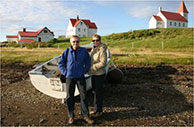
Friday, 5 December 2025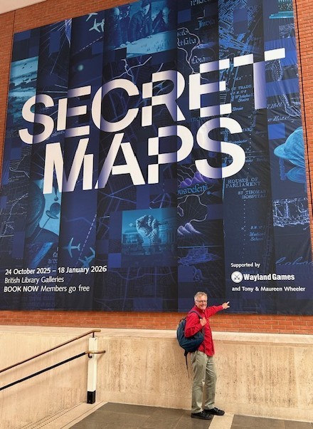 ◄ Until 28 January 2026 the British Library has an intriguing exhibition about ‘secret maps.’ Maureen and I were involved in getting the exhibition off the ground and I’m there with the Secret Maps poster at the British Library.
As the library’s website announces it’s an opportunity to ‘Discover the maps you were never meant to see.’ You can read more about the exhibition in an excellent report published by The Conversation written by Doug Specht, Reader in Cultural Geography & Communication, University of Westminster.
The exhibition’s more than 100 maps and other items tell the story right up to the present day, noting how our smart phones constantly track our movements, producing maps which perhaps we would prefer to keep secret. Or aircraft tracking apps like FlightRadar24 produce maps of where assorted aircraft are flying, the exhibit features the story of tracking Taylor Swift’s aircraft and where it has been flying. I’ve been looking at FlightRadar24 in recent days to track the very-far-from-secret news that currently there are very few aircraft operating in the skies over Venezuela.
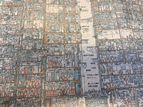 ▲ One of my favourite ‘maps’ at the exhibition is the amazingly detailed 1997 Kowloon Walled City illustration, detailing down to the last T-shirt on a clothesline the secrets of Hong Kong’s closed-off city which was finally demolished in 1994.
Once upon a time, in my Lonely Planet guidebook researching days, finding sources to produce our maps was often difficult, India in particular was very secretive. Particularly when it came to mapping close to the coast or to borders, the border with Pakistan above all. Now with Google Maps and Google Earth it’s easy to find any location on earth. Well most of the time it is. The Secret Maps exhibit – there’s a terrific book to go with the display – notes that you can look as closely as you like at The British Prime Minister’s 10 Downing St residence in London or the US President’s Camp David, about 100km outside Washington DC. Although there’s enough forest around Camp David that Taco Trump would have no trouble finding a tree to hide under. But forget about looking at Macron’s Élysée Palace in the centre of Paris. It’s fogged out on Google Maps and Google Earth.
Their President’s palace isn’t the only location the French try to hide. Once upon a time the Ordnance Survey, Britain’s mapping authority, used to hide away views of British prisons, but gave up when it was clear you could find them on the internet. In France the jails are still hidden away. I’ve also encountered ‘secret’ mapping online in my travels. In 2012 I blogged about The Roundabout Route to Rachel’s Tomb when I had to take an absurdly convoluted path to walk across the line between Palestine and Israel in order to get to the Biblical site. And then discovered how the Israelis had downgraded the resolution of the route I had just walked.
The exhibition notes other ‘disappearances,’ like Apartheid-era South African Automobile Association maps which showed Johannesburg, but totally blanked out the neighbouring black township of Soweto. Well nobody who could afford a car – ie they were white – would want to drive there, would they?

