Djibouti – the city & the country
Saturday, 6 August 2022If chaotic Somalia is Italian Somalia and reasonably together Somaliland is British Somalia then Djibouti is French Somalia. It was known as French Somaliland, but between 1967 and 1977, when it became independent and joined the UN, it became the French Territory of the Afars & the Issas.
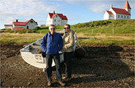
 ◄ Djibouti City at first seems surprisingly orderly after anarchic Hargeisa. There are restarants, cafes, markets, mosques, churches and a cathedral. The rest of the country is nowhere near as organized and Dikhil, well we’ll get to Dikhil.
All of Djibouti only has about a million people, 600,000 of them in Djibouti City. The country’s income overwhelmingly comes from its strategic position and situation. It’s peaceful, orderly, business-like and if you want to be in the ‘Horn of Africa’ well this is the place to be. Of course it’s the military bases which are most evident.
The USA has 4500 personnel at Camp Lemonnier, the only permanent US military base in Africa. You’ll see those big rotor Osprey aircraft lined up as you land at the Djibouti airport, but you won’t see Americans in the city or around the country, they’re not allowed to leave the base. France – well it was a French colony – has about 1500 troops – less than the Chinese who have about 2000. There are also UK, Italian, Japanese, Saudi Arabian, German and Spanish units, all very close to each other. There are not enough Germans to have a base so they stay at the Sheraton Hotel, ditto for the Spanish at the Kempinsky, the most expensive hotel in Djibouti.
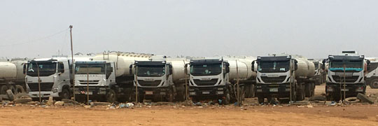 ▲ A fuel tanker truck depot in Djibouti City
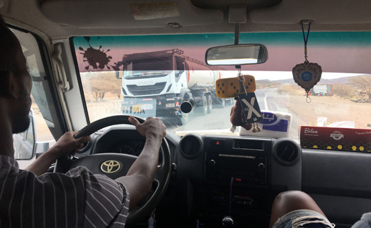
Despite all that military presence it accounts for only 30% of the Djibouti economy. Trade and shipping provides 50% of the nation’s income and that’s extremely evident on the road west out of Djibouti City through Dikhil and on into Ethiopia. The flow of trucks seems to be non-stop in both directions.
 ▲ Trucks heading west across the Petit Barra, bound for Ethiopia
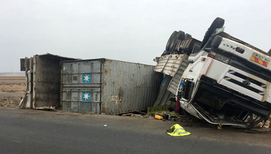 ▲ And all those trucks have more than a few accidents
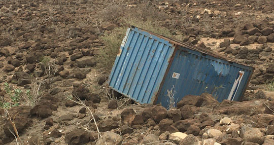 ▲ Once the wrecked trucks are removed the emptied containers often remain, scattered along the roadside.
 ▲ Heading west from Djibouti City the road crosses the Petit Barra and then the Grand Barra – truck stop on the Grand Barra
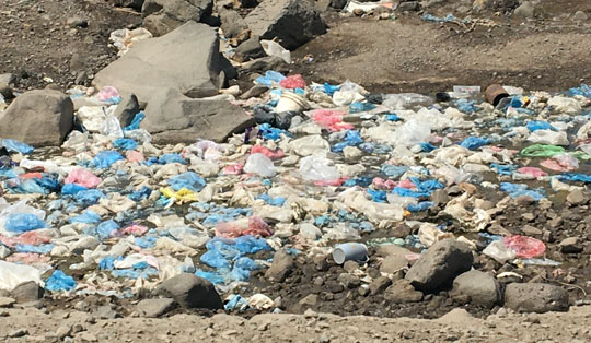 ▲ And then it reaches Dikhil where the road south-west to Lake Abbé splits from the road north-west to Ethiopia. I don’t think I have ever seen a place more thoroughly trashed than Dikhil. Wrecked trucks and cars, wrecked tyres and wheels – and garbage – plastic plastic plastic of course, but every other sort of garbage as well. It really is simply overwhelming, a vision of hell.
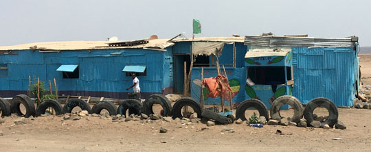
It’s about 75km from Dikhil to Lake Abbé and takes nearly three hours, it often feels like driving in Tibet, different routes heading off in every direction and periodically merging together. At times the track is sandy and reasonably smooth and you can speed along. At other times it’s crawling over the rocks. Remarkably there’s the odd sign of life, suddenly some kids pop up with their goats, twice we see another vehicle. Just past half way is the settlement of As Eyla, not quite as comprehensively trashed as Dikhil …
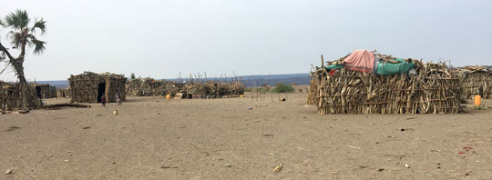 ▲ but much of the habitation in these places looks really makeshift, just bits of wood vertically, loosely looped and wired together, there’s plenty of plastic available to fill the gaps.
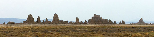 ▲ Lake Abbé is noted for its weird rock formations and the hot springs. Far too hot, they look inviting, but in fact the water is almost at boiling point, you’d do yourself an injury. One of the formation groups was, I’m told, used as a scene in the first Planet of the Apes film. The lake spreads west into Ethiopia, it dropped to its current level and exposed the curious formations when Haile Selassie drained the Ethiopian side of the lake to irrigate cotton fields
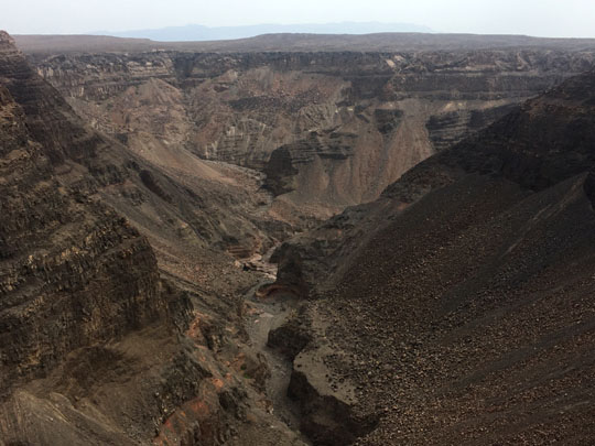 ▲ Canyon d’Adaide
My other trip out of Djibouti City continued around the Gulf of Tadjourah, passing the Canyon d’Adaide and edging the Bay of Ghoubbet, site for Djibouti scuba diving and whale shark swimming. Further round the bay we can see Devil’s Island and on the hillside above the bay a collection of big wind turbines, none of them turning. There’s also a salt shipment harbour and a salt processing facility on the edge of Lake Assal. We descend to the lake, at 155 metres below sea level the lowest point in Africa. Sadly there’s no sea level sign as we descend.
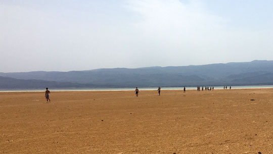
 ▲ At Lake Assal there’s a large contingent of Japanese men – military? – walking back from a float in the lake, I think it’s even saltier than the Dead Sea. I certainly don’t want to indulge without freshwater to wash off with! And back at the car park there’s also an Italian contingent here including a woman in a bikini which would certainly not satisfy any Islamic requirements.
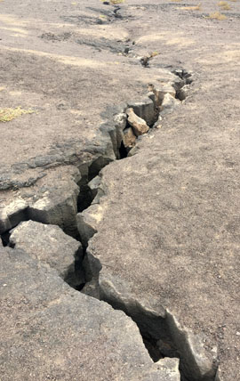
◄ Just after the lake turnoff we take another turn off to check the Volcanos, they’re the result of an eruption in 1978 which left a series of small volcano cones and a definite rift, well this is the rift valley, where Asia and Africa rub up against each other. Today the hot water and steam appearing here is being harnessed for geothermal power. Add the nearby wind turbines (when they’re turning) and plans for a major solar panel array at the Grand Barra and Djibouti could be quite the clean energy centre.
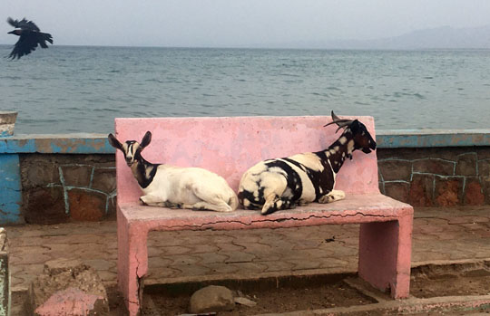 ▲ Tadjourah goats, lounging by the waterfront
We continue around the gulf as far as Tadjourah itself, a town once known as the Town of Seven Mosques, each clan had its own mosque. We go straight through and continue a few km to the turn off to Sables Blanc, Djibouti’s much talked of best-white-sand beach. It’s a tediously rough seven km or so down to the beach, passing a yet to be used new airstrip. Directly across the bay from Djibouti City would be a very short flight.
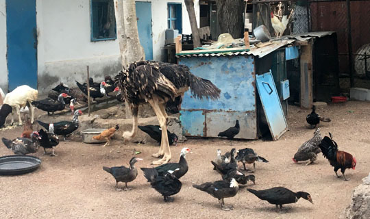 ▲ In Tadjourah we stay the night at the Golfe Hotel. It’s an Old McDonald’s farm with a lot of chickens, ducks, goats, cows, a single forlorn looking rabbit, a larger cage of budgies and a couple of ostrich. And after our visit some pigeons. Akram, my driver-guide in Djibouti, brought some from Djibouti City to add to the owner’s animal collection. I have a cold Ethiopian St George’s Beer at the bar, my first (and it will be the only) alcohol on my Somaliland-Djibouti visit. The bar has a very large collection of caps pinned to the wall, many military ones of course. I add my long-running and rather worn out NAVO (our Silk Road China organiser) Chinese cap from my Silk Road drive from Bangkok to London in 2017.
Given more time there are three places I could have added to my Djibouti itinerary, I’d have dropped Sables Blanc without much regret, but Obock sounds like an interesting town about 75km beyond Tadjourah. It’s 21km off the road to the Foret du Day, but you’d have to factor in some walking. The biggest omission would have to be the Abourma rock art site, but you’d need two hours each way of bad road and two hours of walking, so that’s six hours for starters, I would have needed another day.

