Kiribati – South Tarawa
Monday, 27 November 2017In the British colonial era it was the Gilbert half of the Gilbert & Ellice Islands. Kiribati gained its independence in 1979, became a member of the United Nations in 1999 and has a population of 115,000. Over 50,000 of that population are crammed on to the string of islands which make up South Tarawa.
The Ellice half of the Gilbert & Ellice Islands is now Tuvalu which, like Kiribati, is one of the world’s countries most likely to disappear due to global warming. Perhaps Tuvalu is even more likely to disappear since Kiribati has one ‘high’ island. Like Nauru the island of Banaba was once totally covered in super phosphate, ie guano, ie birdshit. Like Nauru it’s been totally mined out.
 One thing to learn about Kiribati before you even arrive – it’s pronounced Kiri-bass. The ‘ti’ is pronounced as an ‘ss’. Which is why Christmas Island, at the other extreme of the group and all of 3300km from South Tarawa, is spelt Kiritimati – that’s Kiri-ss-ma-ss.
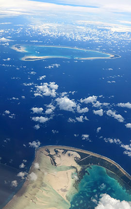
◄ I flew from Nandi in Fiji to South Tarawa on Fiji Airways’ twice weekly flight. There are also flights from Nauru and Majuro in the Marshall Islands with Air Nauru, but the three-hour Fiji connection is probably the standard route to Kiribati. As we approached Tarawa other ‘outer islands’ in the main group came in to view. These are Aranuka, Abatiku and Abemama Islands.
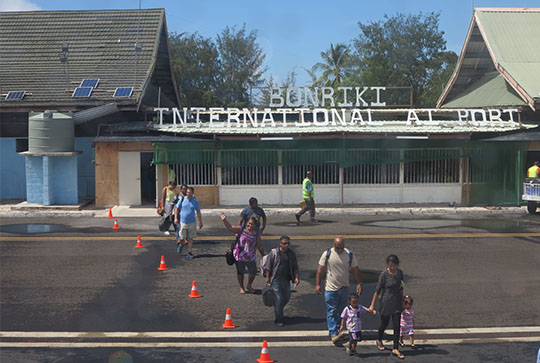 ▲ Bonriki International Airport – or AI PORT since the R has fallen off the sign.
Think of Tarawa as a triangular-shaped atoll. A string of islands linked by causeways runs east-west across the bottom of the triangle, that’s heavily populated South Tarawa. Another string of islands, but not linked by causeways, runs from south-east to north-west, that’s much more lightly populated and less developed North Tarawa. The third side of the triangle is open to the Pacific Ocean.
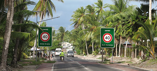 ▲ From the airport at Bonriki, the last island on South Tarawa, the road runs through Bikenibeu and climbs to the highest point on South Tarawa, all of three metres above sea level at Eita, before descending (gently) to Ambo …
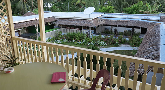
 ▲ where I stayed in the friendly and well-run Utirerei Motel. Forget what used to be the island’s main hotel, the government run Otintaai, which has fallen into total disrepair. There are plenty of other accommodation possibilities on South Tarawa.
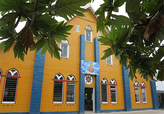
◄ Ambo also features a bright-pink Catholic Church. There are lots of churches along the road and the Catholic ones are the biggest and most colourful. The Mormon Church has a heavy footprint on Kiribati, you pass plenty of their white, neat and tidy, churches, populated by their equally neat and tidy ‘elders.’ Nobody else wears a tie in Kiribati’s tropical heat, they look like ‘50s IBM corporate men.
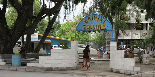 ▲ That single road continues to Bairiki, the second ‘town’ of South Tarawa where Bairiki Square is the closest thing you’ll find to a ‘town centre’ on South Tarawa. The main ANZ bank branch (put your card in the ATM and it dispenses Australian dollars, the currency of Kiribati), the Post Office and the National Library all cluster around the square. The Air Kiribati airline office is a few steps away and the official residence of the Kiribati President.
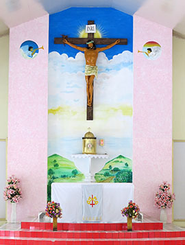
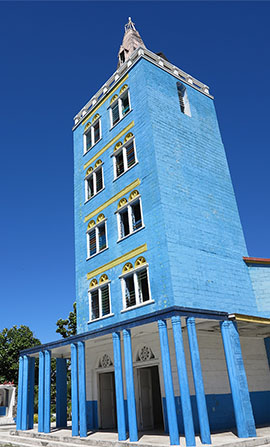
 ▲ Of course there’s a colourful Catholic Church in Bairiki.
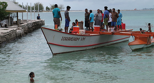
 ▲ Boats operating across the lagoon to the islands of North Tarawa arrive and depart from Bairiki’s harbour. No I have not flipped this photograph, the outrigger’s name is indeed backwards. On the other side it read MV Marinraoi.
◄ The particularly long Nippon Causeway links Bairiki to the third and final town, Betio – pronounced Bessio of course. This is Betio’s brightly painted Catholic Church.
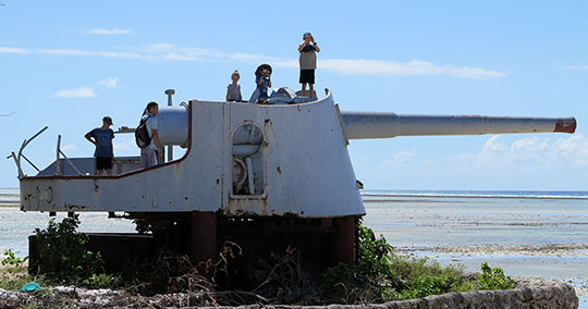 ▲ Betio was the site for the November 1943 Battle of Tarawa, the three-day American amphibious assault on the Japanese held island which led to enormous losses on both sides. The Americans lost nearly 1700 men, the Japanese almost every man on the island, nearly 4700 Japanese troops and labourers and Korean labourers died. Only 17 Japanese men were captured alive. On the ocean side of the island a British gun, captured by the Japanese from Singapore, still points out to sea. Bunkers and guns dot the coastline along this side of the island. The Betio Memorial commemorates the islanders who suffered and died under the Japanese hands and the 22 New Zealanders and British who were executed here on 15 October 1942.
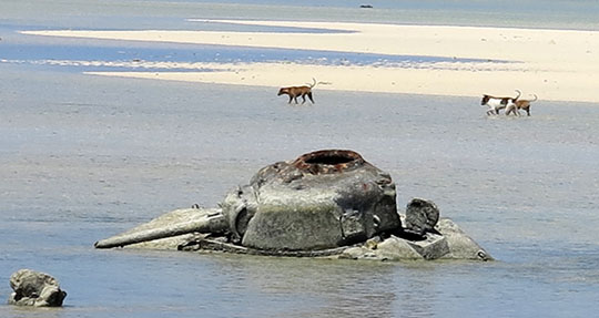
 ▲ While on the lagoon-side an American Sherman tank didn’t quite make it to shore. Nearby is the Japanese command bunker, 300 bodies were found inside the bunker when it was finally captured. Look on You Tube for the 19 minute ‘With the Marines at Tarawa’ film about the invasion.
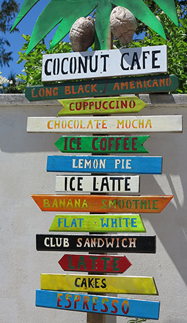
◄ If you need a real coffee in Kiribati there are two places to go, one is the Coconut Café in Betio. The other is almost at the other end of South Tarawa at Chatterbox in Bikenibeu.
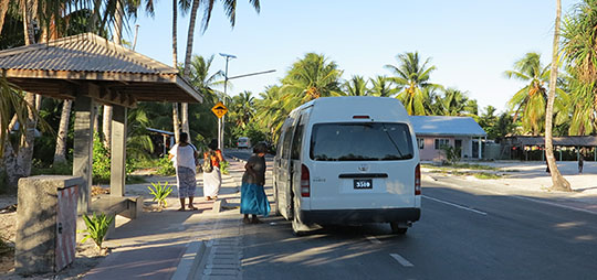 ▲ Getting around on South Tarawa is dead easy, these minibuses shuttle back and forth along that one long, island-linking road. Flag one down, squeeze on board and pay when you get out, the fare generally seemed to be about a dollar. It’s 30km all the way from Betio at the western end to Bonriki Airport at the eastern and since there’s only one road it’s impossible to get lost.
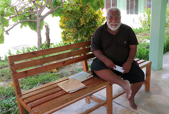
 ▲ Kaure Babo, member of parliament for the island of Maiana. I got talking to him when I stopped by the Parliament Building to look around. Three years ago I had lunch in Melbourne with Anote Tong, the Kiribati President at the time, who was in Australia en route to Paris for a climate change conference. He is also from Maiana.
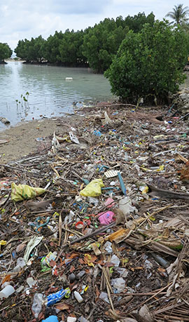
◄ At times it seems like South Tarawa is going to submerge under a sea of garbage before it’s covered by rising ocean levels. Rubbish disposal is a huge problem on a tiny, densely populated atoll.
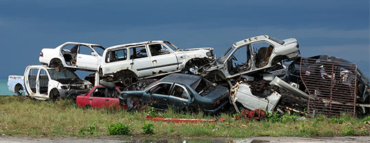 ▲ And it’s not just plastic bottles and the other slow-degrading debris of modern life. South Tarawa also seems to be submerging under a heap of dumped cars, buses and trucks. They often seem to be abandoned at a remarkably young age and I never spotted anywhere where vehicles were being maintained and repaired. Are they just run until they drop? Safe drinking water is also a big problem on South Tarawa and yet comparatively few roofs were hooked up to water catch tanks. The big meeting houses known as maneabas sometimes featured catch tanks, but by no means all of them.
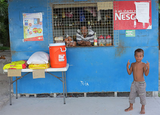 ▲ A roadside shop on South Tarawa. Despite the problems I didn’t find South Tarawa a gloomy place. Alexander Downer, Australia’s unlamented foreign minister during the John Howard government, pronounced Kiribati the second worst place he’d ever had to visit. Nauru was the winner as his ‘worst place’ so presumably if Kiribati had moved up one spot it could have been Australia’s Pacific refugee prison camp instead of Nauru.
The garbage problem could clearly be tackled and there are lots of other solutions to Kiribati’s problems. The overcrowding never seemed as bad as I’d been warned and, of course, you’re not going to bump into many other tourists. A recent Daily Mail online article listed the 15 ‘least touristed’ countries, only neighbouring Tuvalu attracted less visitors than Kiribati. Unfortunately Lonely Planet’s South Pacific guide no longer covers Kiribati, although earlier editions devoted 24 pages to the country, and Moon Publication’s South Pacific Handbook is out of print. Check Darren McLean’s taste2travel posting on Kiribati for more information.
I spent just a week on Kiribati, but I did manage to get at least a little beyond crowded South Tarawa. In the next few days I’ll post about my stay on North Tarawa, brief visits to a couple of the Outer Islands and a review of the only recent book about Kiribati, J Maarten Troost’s very amusing The Sex Lives of Cannibals.

