Flinders & King Islands
Friday, 5 December 2014They’re the two islands half way across Bass Strait, between the island state of Tasmania to the south and mainland Australia to the north. Although island residents tend to call Tasmania ‘the mainland.’ And despite living in Melbourne for many years and making many trips down to Tasmania I’d never been to the islands, apart from a very short stop on Flinders in a helicopter coming back from even smaller Deal Island a few years ago. So the opportunity to join a small group making a triangular trip in a light aircraft Melbourne-Flinders-King-Melbourne was not to be missed.
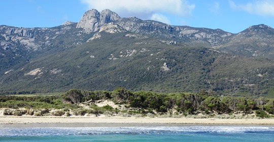 ▲ Flinders has a much more varied topography than King Island, much of which is fairly flat. This view from Trousers Point towards the north-west corner of the island takes in Strezelecki Peak, a good place to climb if you have the time.
 ▲ There’s some dramatic coast and beaches around the island, often with the orange lichened rocks which you also find to the north around Wilson’s Prom in Victoria or south along the east coast of Tasmania. This views is at the North-East River outlet.
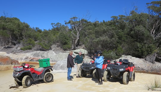 ▲ We took quad bikes to explore the rougher trail around the north-west corner of Flinders Island, from where you can look across to Cape Barren Island, which has a small Aboriginal population Wybalena marks the sorry end point for Tasmania’s Aboriginal population, having tried, fairly successfully, to wipe them out the early European settlers then shifted the final survivors to Flinders Island, where they soon died out. Of course lots of remnants remained, but the whole Aboriginal story in Tasmania is even more miserable than the rest of Australia. There’s really not much to see at Wybalena, just a sparse graveyard and the old chapel. The Furneaux Museum in Emita is much more interesting, lots of Aboriginal, early colonial and shipwreck artefacts.
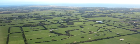
 ▲ In comparison to Flinders, the scenery is green and lush on King Island. The island is famous for its cheese production.
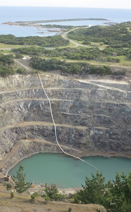
◄ Grassy is a small settlement and port on the east side of the island. This large hole in the ground is the abandoned Grassy scheelite open cut mine. Scheelite is an ore from which tungsten is extracted and the price for tungsten (and scheelite) has got high enough to make reopening the mine a firm possibility. Given that the island looked so flat and low-lying as we flew in it’s surprising how high the coast is here.
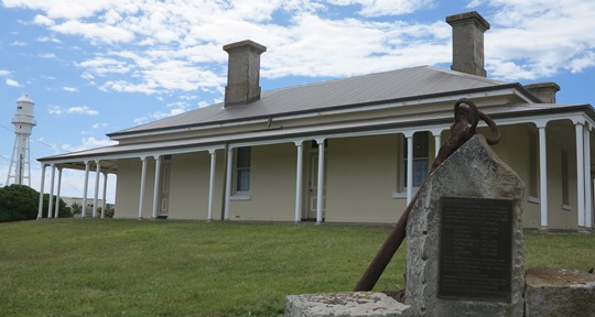
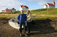
 ▲ Currie is the island’s main settlement and has a fine little museum and an adjacent lighthouse, both overlooking the harbour.
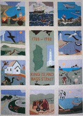
◄ I really liked the museum’s King Island quilt – from 1988 – which tells the whole King Island story: the harbour, early colonists and their ships, sealers, the seaweed industry, farming and the dairy business, crayfishing, wildlife, it’s all here.

