Climbing Mt Warning (Wollumbin)
Monday, 8 February 2016Well perhaps you shouldn’t climb it, some people say the local Aboriginal Bundjalung are unhappy about ascents of Wollumbin, rather like Uluru (Ayers Rock) in Central Australia. On the other hand when you get to Wollumbin National Park, starting point for the Mt Warning ascent, you’re simply requested to be respectful when making the climb.
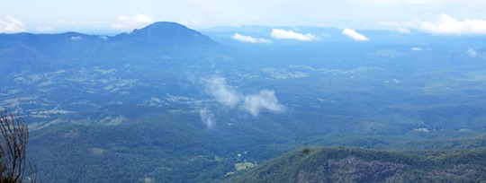 ▲ The view from Mt Warning – looking inland, unfortunately looking in the other direction, towards Byron Bay and the coast, was obscured by cloud.
 The English name comes courtesy of Captain Cook who reported spotting ‘a remarkable sharp peaked Mountain lying inland’ and naming it Mt Warning as northbound sailors should take care because they’d soon encounter Point Danger, today it marks the dividing line between New South Wales and Queensland.
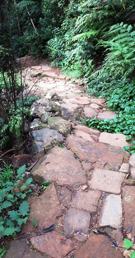
◄ From the Breakfast Creek starting point it’s 8.8km up to the top and back down along a remarkably well kept path, much of it beautiful stone work. Allow five hours for the climb and descent, you start at 438 metres at the Breakfast Creek car park and the lookout on top is at 1159 metres
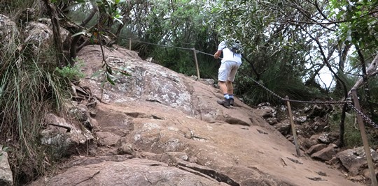 ▲ On the final steep ascent a guide chain helps you clamber up the rocks, like a via ferrata – ‘iron road’ – in the Dolomites in Italy.

